|
My Project
|
|
My Project
|
#include <TerrainNav.h>
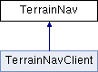
Public Member Functions | |
| TerrainNav () | |
| TerrainNav (char *mapName) | |
| TerrainNav (char *mapName, char *vehicleSpecs) | |
| TerrainNav (char *mapName, char *vehicleSpecs, const int &filterType) | |
| TerrainNav (char *mapName, char *vehicleSpecs, const int &filterType, char *directory) | |
| TerrainNav (char *mapName, char *vehicleSpecs, const int &filterType, const int &mapType) | |
| TerrainNav (char *mapName, char *vehicleSpecs, const int &filterType, const int &mapType, char *directory) | |
| virtual | ~TerrainNav () |
| virtual void | estimatePose (poseT *estimate, const int &type) |
| virtual void | measUpdate (measT *incomingMeas, const int &type) |
| virtual void | mbUpdate (mbT *incomingMeas) |
| virtual void | motionUpdate (poseT *incomingNav) |
| virtual bool | outstandingMeas () |
| virtual bool | lastMeasSuccessful () |
| virtual void | setInterpMeasAttitude (bool set) |
| virtual void | setMapInterpMethod (const int &type) |
| virtual void | setVehicleDriftRate (const double &driftRate) |
| virtual bool | isConverged () |
| virtual int | getFilterType () |
| virtual void | useLowGradeFilter () |
| virtual void | useHighGradeFilter () |
| virtual void | setFilterReinit (const bool allow) |
| void | reinitFilter (bool lowInfoTransition) |
| virtual void | setModifiedWeighting (const bool use) |
| virtual int | getFilterState () |
| virtual int | getNumReinits () |
| virtual bool | initialized () |
Public Attributes | |
| TNavFilter * | tNavFilter |
Protected Member Functions | |
| void | createFilter (const int filterType, const double *windowVar) |
| void | initVariables () |
| void | attemptInitFilter (poseT &initEstimate) |
| void | initMotion (poseT &initEstimate) |
| bool | interpolatePoses (const poseT &pose1, const poseT &pose2, poseT &newPose, const double newTime) |
| void | computeMeasVariance (measT &currMeas) |
| void | checkVelocityValidity (poseT &currPose) |
| void | checkRangeValidity (measT &currMeas) |
| bool | checkFilterHealth () |
Protected Attributes | |
| measT | waitingMeas [MEAS_BUFFER_SIZE] |
| static array containing all unincorporated sonar measurements More... | |
| int | numWaitingMeas |
| integer indicating the current number of unincorporated sonar measurements More... | |
| bool | lastMeasSuccess |
| double | lastValidVel [3] |
| bool | lastVelBotLock |
| bool | lastMeasValid |
| status of last measurement - only used for testing initialization More... | |
| double | lastValidRange [4] |
| double | lastValidRangeTime [4] |
| bool | noValidRange [4] |
| double | lastMeasSuccessTime |
| last time associated with successful measurement update More... | |
| double | lastInitAttemptTime |
| time of last filter init attempt More... | |
| double | lastBottomLockTime |
| time of last bottom lock velocity More... | |
| poseT | estNavOffset |
| last valid estimated navigation offset More... | |
| bool | allowFilterReinits |
| boolean indicating if filter reinitializations are allowed. More... | |
| bool | useModifiedWeighting |
| boolean indicating if modified weighting should be used. More... | |
| int | numReinits |
| counter for number of filter reinitializations More... | |
| char * | saveDirectory |
| char * | vehicleSpecFile |
| char * | mapFile |
| int | filterType |
| type of filter More... | |
| int | mapType |
| type of map More... | |
| TerrainMap * | terrainMap |
| terrainMap object containing information about current map being used More... | |
| bool | _initialized |
| current state of filter More... | |
Class: TerrainNav
This class is used as an interface between a user and the underlying TNavFilter object which uses a terrain navigation algorithm to compute pose estimates based on sonar and inertial sensor measurements. This class's primary purpose is to appropriately handle incoming inertial and sonar measurements, pass them to the underlying TNavFilter object, and return pose estimates when requested by the user.
Intended use:
 Generate terrainNav object and estimate structures once at the start:
       TerrainNav *tercom = new TerrainNav(mapName, vehicleName,
                                          filterType);
   poseT* tercomEst = new poseT;
       poseT* currInertialPose = new poseT;
       measT* currMeas = new measT;

 Incorporate inertial sensor information as it comes in:
      tercom->motionUpdate(currInertialPose);

 Incorporate sonar measurements as they come in:
       tercom->measUpdate(currMeas, dvl);

 Ask for most recent terrain navigation pose estimate:
       tercom->estimatePose(tercomEst, mmse);

 ***NAVIGATION AND MEASUREMENTS MUST BE ADDED SEQUENTIALLY IN TIME,
    OTHERWISE SOME MEASUREMENTS MAY BE SKIPPED***
Note: This class can handle various combinations of sonar and inertial sensor data rates. If the sonar and inertial sensor measurements are out of sync, the inertial pose measurements are interpolated to provide an estimate of the vehicle pose associated with each sonar measurement. If the sonar data rate is faster than the inertial sensor data rate, sonar measurements are collected and stored until the next inertial sensor measurement comes in, at which point all collected measurements are added into the navigation filter in sequence.
|
inline |
| TerrainNav::TerrainNav | ( | char * | mapName | ) |
Initializes a new TerrainNav with terrain map "mapName.txt". The mapping AUV specs and the Point Mass Filter algorithm are used as defaults.
| TerrainNav::TerrainNav | ( | char * | mapName, |
| char * | vehicleSpecs | ||
| ) |
Sets private variables mapFile = "mapName.txt", vehicleSpecFile = "vehicleName.txt", and saveDirectory = NULL, default mapType = 1 (DEM). Makes a call to createFilter(1) to initialize a new TerrainNav object with default type = 1 (Point Mass Filter).
| TerrainNav::TerrainNav | ( | char * | mapName, |
| char * | vehicleSpecs, | ||
| const int & | filterType | ||
| ) |
Sets private variables mapFile = "mapName.txt", vehicleSpecFile = "vehicleName.txt", and saveDirectory = NULL, default mapType = 1 (DEM). Makes a call to createFilter(filterType) to initialize a new TerrainNav object with specified type.
| TerrainNav::TerrainNav | ( | char * | mapName, |
| char * | vehicleSpecs, | ||
| const int & | filterType, | ||
| char * | directory | ||
| ) |
Sets private variables mapFile = "mapName.txt", vehicleSpecFile = "vehicleName.txt", and saveDirectory = "directory", default mapType = 1 (DEM). Makes a call to createFilter(filterType) to initialize a new TerrainNav object with specified type.
| TerrainNav::TerrainNav | ( | char * | mapName, |
| char * | vehicleSpecs, | ||
| const int & | filterType, | ||
| const int & | mapType | ||
| ) |
Sets private variables mapFile = "mapName.txt", vehicleSpecFile = "vehicleName.txt", and mapType = mapType (1 is DEM, 2 is octree). Makes a call to createFilter(filterType) to initialize a new TerrainNav object with specified type.
| TerrainNav::TerrainNav | ( | char * | mapName, |
| char * | vehicleSpecs, | ||
| const int & | filterType, | ||
| const int & | mapType, | ||
| char * | directory | ||
| ) |
Sets private variables mapFile = "mapName.txt", vehicleSpecFile = "vehicleName.txt", and saveDirectory = "directory", mapType = mapType (1 is DEM, 2 is octree). Makes a call to createFilter(filterType) to initialize a new TerrainNav object with specified type.
|
virtual |
Frees all storage associated with the TerrainNav object.
|
protected |
Try to initialize the terrain navigation filter, TNavFilter, based on the first inertial sensor measurement contained in the initEstimate poseT structure. Initialization is only allowed if the following conditions are met:
|
protected |
This function checks the health of the filter and calls the reinitFilter() function if necessary. This checks the health by performing the following checks: a. Check if the length of time since the last successful measurement exceeds a set maximum. (uses lastMeasSuccessTime) b. Check if the x/y uncertainty of the filter exceeds a set maximum. (uses currVar)
|
protected |
Check validity of Measured ranges. If invalid, changes beamStatus flags in currMeas to false. Validity check is based on the following:
|
protected |
Check validity of DVL/INS velocity. If invalid, changes dvlValid flag in currPose to false. Validity check is based on the following:
|
protected |
Fills in the covariance array of the "currMeas" measT struct with a % of the measured range for each beam. If the covariance array is already filled or the current measurement has no corresponding sensor type, this function returns without making any changes. Otherwise, the percentRangeError property of the corresponding sensor is used to evaluate the variance as follows: sigma = percentRangeError*range;
|
protected |
Sets octreeMap in tNavFilter to oMap.
Initializes the terrain navigation filter object based on the specified filter type: 1: 3D Point Mass Filter (default - TODO:Make Other Filter Types work?) 2: 8D Particle Filter
windowVar is used to size the initalization window for the new filter.
If the filter object already exists, this function will delete the current filter object and create a new one with stored saveDirectory, vehicleSpecFile and mapFile.
|
virtual |
This is the primary function in the TerrainNav class. The function takes in a pointer to a poseT which it fills with the terrain correlation pose estimate based on previous measurements. The time stamp of the pose estimate indicates the last update time of the navigation filter. Type indicates the estimator type: 1: Maximum Likelihood Estimate 2: Minimum Mean Square Error Estimate.
Reimplemented in TerrainNavClient.
|
inlinevirtual |
Returns the integer filterState describing the current filter state.
Reimplemented in TerrainNavClient.
|
inlinevirtual |
Returns the integer filterType describing the current TNavFilter type.
|
inlinevirtual |
Returns the integer numReinits describing the number of reinitializations.
Reimplemented in TerrainNavClient.
|
inlinevirtual |
|
protected |
Initializes the terrain navigation filter, TNavFilter, based on the first inertial sensor measurement contained in the initEstimate poseT structure.
|
protected |
Initializes private variables associated with a terrainNav object
|
protected |
Linearly interpolates pose information from pose1 and pose2 to a new pose at time newTime. The interpolated pose is recorded in newPose.
|
inlinevirtual |
Returns a boolean indicating if the terrain navigation filter has converged to an estimate.
Reimplemented in TerrainNavClient.
|
inlinevirtual |
Returns a boolean indicating if the last sonar measurement was successfully incorporated into the filter or not.
Reimplemented in TerrainNavClient.
|
virtual |
Passes the current multibeam range information along to the TNavFilter object. The function takes in a pointer to a mbT containing the current multibeam measurement ranges.
Reimplemented in TerrainNavClient.
|
virtual |
Passes the current sonar measurement information along to the TNavFilter object. The function takes in a pointer to a measT containing the current sonar measurement information. It also takes in an integer type variable which relates the sonar measurement type as follows: 1: DVL 2: Multibeam 3: Single Beam 4: Homer Relative Measurement
Reimplemented in TerrainNavClient.
|
virtual |
Passes the current inertial measurement information along to the TNavFilter object. The function takes in a pointer to a poseT containing the current inertial measurement information.
Reimplemented in TerrainNavClient.
|
inlinevirtual |
Returns a boolean indicating if there are any measurements not yet incorporated into the PDF and waiting for more recent inertial measurement data.
Reimplemented in TerrainNavClient.
| void TerrainNav::reinitFilter | ( | bool | lowInfoTransition | ) |
This function reinitializes the filter. It will copy relevant information from the current filter object, delete that object, then re-create the filter.
23-Aug-2016 RGH : Exposing for use with TerrainAid and TerrainNavClient
|
inlinevirtual |
Overwrite boolean allowFilterReinits with input argument, allow.
Reimplemented in TerrainNavClient.
|
inlinevirtual |
Sets a boolean indicating if the sonar measurement attitude information should be determined from interpolated inertial poses. Default = 0;
Reimplemented in TerrainNavClient.
|
inlinevirtual |
Specifies the interpolation method to use for determining inter-grid map depth values. 0: nearest-neighbor (no interpolation) 1: bilinear 2: bicubic 3: spline Default = 0;
Reimplemented in TerrainNavClient.
|
inlinevirtual |
Overwrite boolean useModifiedWeighting with input argument, use.
Reimplemented in TerrainNavClient.
|
inlinevirtual |
Sets the vehicle inertial drift rate parameter. The default value is determined by the vehicle specification sheet. The driftRate parameter is given in units of % drift in meters/sec.
Reimplemented in TerrainNavClient.
|
inlinevirtual |
Force filter settings for low grade system: 3DOF system with ALLOW_ATTITUDE_SEARCH=0, DEAD_RECKON=0, SEARCH_GYRO=0
Reimplemented in TerrainNavClient.
|
inlinevirtual |
Force filter settings for low grade system: 7DOF system with ALLOW_ATTITUDE_SEARCH=1, DEAD_RECKON=1, SEARCH_GYRO=1
Reimplemented in TerrainNavClient.
|
protected |
current state of filter
pcl pointcloud object containing current map when using octree boolean indiating true if initialized successfully (i.e., the mapfile was found)
|
protected |
boolean indicating if filter reinitializations are allowed.
|
protected |
last valid estimated navigation offset
|
protected |
type of filter
|
protected |
time of last bottom lock velocity
|
protected |
time of last filter init attempt
|
protected |
boolean indicating if the previous sonar measurement was successfully incoporated into the navigation filter
|
protected |
last time associated with successful measurement update
|
protected |
status of last measurement - only used for testing initialization
|
protected |
|
protected |
|
protected |
array containing the last good velocity measurements and bottom-lock status / Velocity is given in the body frame
|
protected |
|
protected |
|
protected |
type of map
|
protected |
|
protected |
counter for number of filter reinitializations
|
protected |
integer indicating the current number of unincorporated sonar measurements
|
protected |
|
protected |
terrainMap object containing information about current map being used
| TNavFilter* TerrainNav::tNavFilter |
tNavFilter object used to recursively incorporate vehicle measurements according to a terrain navigation algorithm
|
protected |
boolean indicating if modified weighting should be used.
|
protected |
|
protected |
static array containing all unincorporated sonar measurements
 1.8.6
1.8.6

