Current Position Point Cloud
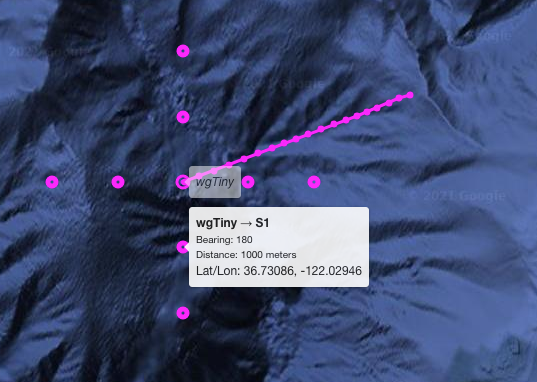
The "Current Position Points Cloud" feature is about displaying a predetermined set of points that will be positioned with respect to the latest position of a given asset (from the tracking database, see Displaying Other Assets). Each of these points is defined in terms of bearing and distance from the asset position.
-
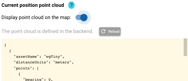
The point cloud definitions are manually done in the backend.
-
In the example described here, the current position points are defined for the wave glider "Tiny," which is identified as
wgTinyin the tracking database. -
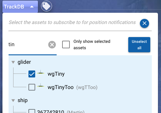
The Dash UI will display such point definitions on the map if you have the corresponding asset selected via the TrackDB dropdown.
-
Settings associated to this handling can be found in the section 'Frontend Settings -> Map -> Current position point cloud':
-
'Reload' allows refreshing the definitions from the backend.
- The 'Display on the map' toggle allows controlling whether to display the point cloud or not.
As shown in the screenshot at the top of this page, the tooltip for each of the associated points will include relevant details (bearing, distance to the asset, latitude, and longitude).