Waypoint visualization
Dash applies the following logic to eventually display the waypoints (as a sequence of lines connecting such points) associated to a running mission on the map:
-
The logic is triggered when the
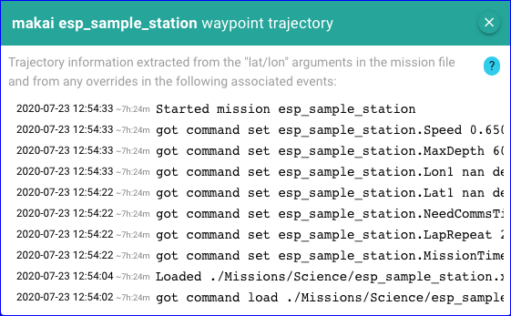
Started mission <ID>important event is received, where the<ID>is what is captured in the mission script as follows depending on the language:- For a TethysL script, the mission name is as indicated for the
missionconstruct when given explicitly, e.g., it will beSomeIdfor:or otherwise inferred from the simple name of the script file.mission SomeId { ... } - For an XML script, the mission name is determined by the
Idattribute;
- For a TethysL script, the mission name is as indicated for the
-
Then, Dash will gather the waypoints from:
-
The arguments in the corresponding mission file that refer to "latitude" or "longitude" (see below).
-
All immediately preceding
setcommands in the event flow (with respect to theStarted missionevent) overriding any such arguments.
-
-
Extraction of latitude/longitude positions to collect the waypoints is ONLY based on:
-
Any defined arguments in the mission with the following names: Lat, Lon, Latitude, or Longitude, as well as those same names with a numeric suffix, e.g., Lat1, Longitude7.
Dash will pair such names, e.g.,
Lat3andLon3, with the assumption that they define specific locations. -
Any "set" commands in the event flow that look like the following (using Lat3 as an example):
got command set <mission-name>.Lat3 <val> degree
-
For a displayed set of waypoints, clicking or tapping on any of the dashed lines will open a popup containing the following:
- Last started mission event
- Vehicle position at time of the started mission event
- All collected (non-NaN) waypoints
- Hovering the mouse on a line with coordinates will highlight the corresponding position on the map
-
A "center at" button to center the map at the given position
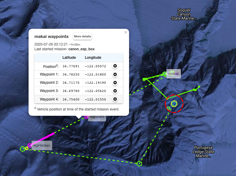
-
A button 'More details' to open one other popup with further details about the relevant mission events: